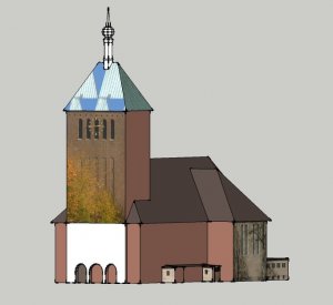
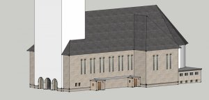
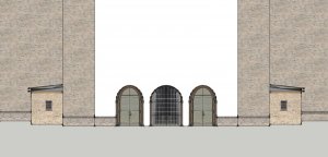
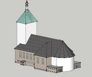
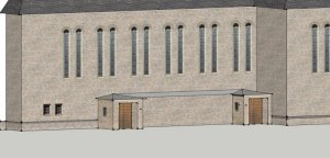
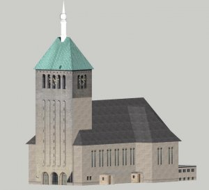
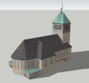
Right in the middle of my home town there are two churches: the big church of Saint George and the smaller church of Saint Felicity. Both have a very long and interesting history and were rebuilt and refitted several times.
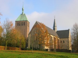
If you want to know more about them please have a look at this page. Google translator is your friend.
For several years now I had the idea to turn them into paper. But as always time was rare and other projects, life and work interfered. With the beginning of 2020 I decided to finally swing into action - come what may.
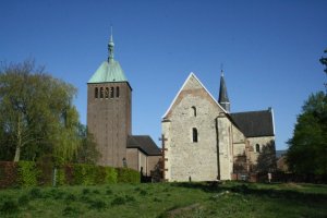
However, this time something interfered which no-one was able to foresee: Corona. As a result of the nation-wide shutdown I was unable to reach out to anyone who could supply me with the most vital information for this project: dimensions. I had no idea how big and tall the building was. In normal times I could have contacted our priests, the tourist information office or the local heritage society - but not now. Everyone was unavailable. The scarce info I had already gathered from the library and the documents inside the church showed a very crude blueprint, drawn with the fattest lines you can imagine, again without any numbers, and some pictures from the 1950s. To make a long story short, I had absolutely nothing to work with.
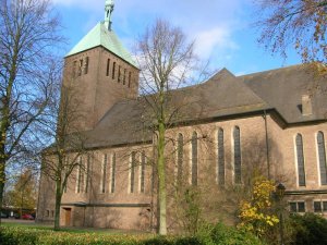
But wait - there was something that could give me the answers I needed: the most obvious - the building itself!
Armed with my camera, some sheets of paper, a pencil and a folding ruler I went to the church place and recorded all dimensions I could determine.
I started with the back side of the building and wrote everything down to get a feel for it.
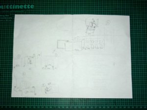
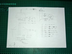
When I noticed that chances aren't too bad I walked around the building and made a very rough sketch of the floor plan. Whenever I got a new number I added it to the respective piece of the plan.
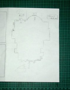
Since the church was closed and only very few people were around due to Corona there was no-one disturbing me.
The first wow moment was when I noticed that the church was obviously symmetrical, so I only needed to check out one side.
There was a curved protrusion at the end of the church. I eye-balled parallel lines and measured the width and depth of the area in question (you can see that at the top of the above image).
I had no idea if my measurements were correct and could not wait to turn the numbers into a new SketchUp drawing.
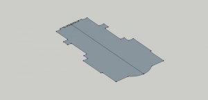
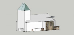
Much to my elation the cleaned up drawing was pretty close to what it was supposed to be like. My measurements deviated by 1.2m (width) and 1.6m (length) which was absolutely acceptable. The protrusion matched up pretty well, too, so I pulled up the first floor.
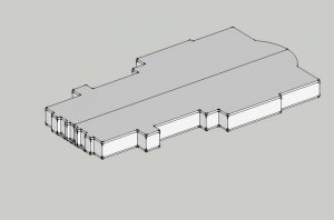
That was pretty easy because I could measure the height with the ruler. Everything above was trickier. For the next height info (the bottom of the smaller roof) I used a straight-on picture of the back part of the building.
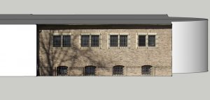
I pulled up the area till it met the top line. Done.
Next I used another image that showed the beginning of the big roof and pulled up the building more.
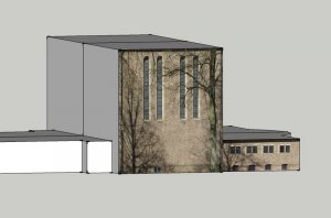
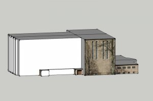
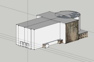
Done.
But now I reached my physical limits. I had no height info for the tower and the top of the roof. What should I do?
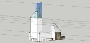
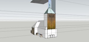
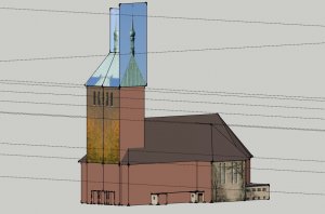
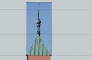
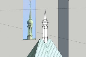
I suspected the stones to have the same height and started to count the number of rows to determine additional height data. Unfortunately I found out that this did not work out that well. There were small deviations from row to row which added up. As a result the big image got distorted and did not match up with the smaller one and the tower literally shot up into the sky.
I told me there must be a way to solve this dilemma and in fact there was one. A very clever one.
Which one, you might ask.
Well, I'll tell you in the next post!

If you want to know more about them please have a look at this page. Google translator is your friend.
For several years now I had the idea to turn them into paper. But as always time was rare and other projects, life and work interfered. With the beginning of 2020 I decided to finally swing into action - come what may.

However, this time something interfered which no-one was able to foresee: Corona. As a result of the nation-wide shutdown I was unable to reach out to anyone who could supply me with the most vital information for this project: dimensions. I had no idea how big and tall the building was. In normal times I could have contacted our priests, the tourist information office or the local heritage society - but not now. Everyone was unavailable. The scarce info I had already gathered from the library and the documents inside the church showed a very crude blueprint, drawn with the fattest lines you can imagine, again without any numbers, and some pictures from the 1950s. To make a long story short, I had absolutely nothing to work with.

But wait - there was something that could give me the answers I needed: the most obvious - the building itself!
Armed with my camera, some sheets of paper, a pencil and a folding ruler I went to the church place and recorded all dimensions I could determine.
I started with the back side of the building and wrote everything down to get a feel for it.

When I noticed that chances aren't too bad I walked around the building and made a very rough sketch of the floor plan. Whenever I got a new number I added it to the respective piece of the plan.

Since the church was closed and only very few people were around due to Corona there was no-one disturbing me.
The first wow moment was when I noticed that the church was obviously symmetrical, so I only needed to check out one side.
There was a curved protrusion at the end of the church. I eye-balled parallel lines and measured the width and depth of the area in question (you can see that at the top of the above image).
I had no idea if my measurements were correct and could not wait to turn the numbers into a new SketchUp drawing.

Much to my elation the cleaned up drawing was pretty close to what it was supposed to be like. My measurements deviated by 1.2m (width) and 1.6m (length) which was absolutely acceptable. The protrusion matched up pretty well, too, so I pulled up the first floor.

That was pretty easy because I could measure the height with the ruler. Everything above was trickier. For the next height info (the bottom of the smaller roof) I used a straight-on picture of the back part of the building.

I pulled up the area till it met the top line. Done.
Next I used another image that showed the beginning of the big roof and pulled up the building more.


Done.
But now I reached my physical limits. I had no height info for the tower and the top of the roof. What should I do?
I suspected the stones to have the same height and started to count the number of rows to determine additional height data. Unfortunately I found out that this did not work out that well. There were small deviations from row to row which added up. As a result the big image got distorted and did not match up with the smaller one and the tower literally shot up into the sky.
I told me there must be a way to solve this dilemma and in fact there was one. A very clever one.
Which one, you might ask.
Well, I'll tell you in the next post!
Last edited:
