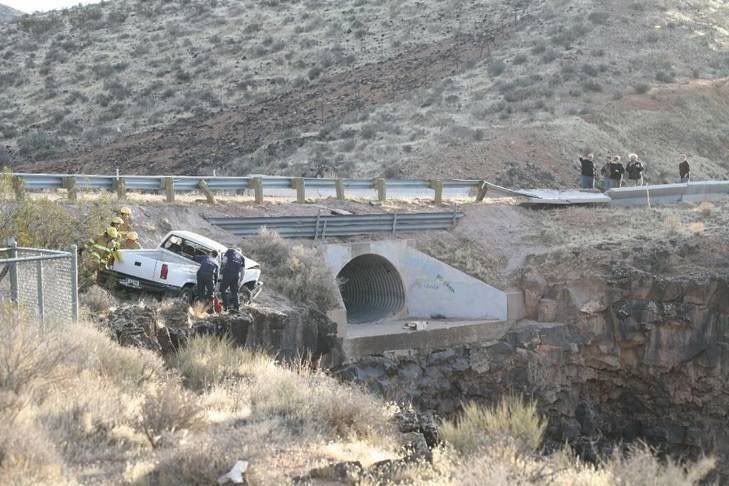
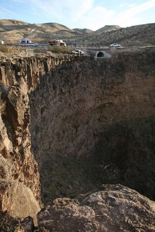
Sorry, got a new phone today and well, I have been playing with that
That is right at the beginning of State route 59. You climb a fairly steep hill leaving Hurricane heading toward Apple Valley. That cliff is about the first curve once your reach the top of the cliff, although to be were they where they had to be decending off of the mesa. It is under 20 miles from our house, and we have driven that lots of times, as that is the fastest way to get to Phoenix from where we live.
Here is a link to the google map image of the area, the cliff is in the shade in the picture:
hurricane,UT - Google Maps
P.S. Looking at that picture again, I have no idea which direction they were going
It looks like they jumped the culvert, so maybe they were heading up the hill. No clue, but they sure where lucky.